Olympic National Park Guide
One of America’s greatest national parks lies in the most northwestern corner of the lower 48 states. Just west of Seattle awaits a wilderness that is unique in the world, a vast expanse of mountain ranges, lakes, coastline and rain forests. This park is epic—I can’t call it anything else—and deserves at least two days. So, in this post, I’ve outlined how to spend 2 days in Olympic National Park, the bare minimum to experience its mind-boggling variety.
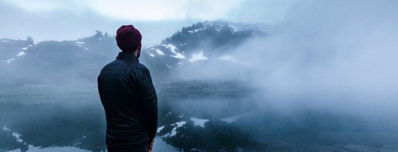
If you love the color green, Olympic National Park is for you. With plenty of rain throughout the year, the park is in a constant state of insanely beautiful green. It contains 922,651 acres including glacier-capped mountains, 60 miles of wild Pacific coast and magnificent stands of old-growth and temperate rain forest. There are over 1,100 species of native plants, 300 species of birds and 70 species of mammals. My personal favorites are the waterfalls, which fall from cliff faces into pools of crystal clear water.
Olympic National Park in Washington State provides activities for the novice and veteran mountaineer. A good place to begin any adventure in the park is the visitor centers. These are located in Port Angeles, Hurricane Ridge, and the Hoh rain forest. They provide exhibits and visitor information, including maps, permits, recreation guides, etc. The Olympic National Park Visitor Center in Port Angeles is open and staffed year-round and serves as the park’s primary information and orientation center. Exhibits are also located at the following ranger stations: Staircase, Storm King (at Lake Crescent), Ozette and Kalaloch.
Nearly 600 miles of trails traverse the park, ranging from short, easy loop trails to rigorous and primitive trails along with high passes or rugged ocean beaches. Topographic maps, and often tide tables, are a must for most hikes. Vehicle access to various points around the park can be gained by way of 168 miles of roads. All park roads are spur roads’ from U.S. Highway 101.
The National Park Service operates 16 campgrounds with a total of 910 sites. Camping fees vary throughout the park depending on the services and amenities. All sites are available on a first-come, first-served basis. Some campground remains open throughout the winter.
How to Spend 2 Days in Olympic National Park
Olympic National Park is not a park that’s particularly easy to visit. For one, there are no roads that run through its interior, which is dominated by Mount Olympus. The only main access road is Highway 101. This scenic road loops around the park’s edges, while a few side roads lead a bit deeper into the park. On top of that, the Olympic Peninsula is pretty large and getting around often takes more time than you might expect.
Therefore, a visit to Olympic requires some advance planning and a rental car. Know what you want to see and do and when you’re going to do that. Two long days are the absolute minimum amount of time you need to do the park justice. Here’s how to spend those 2 days in Olympic National Park in the most efficient way.
Day 1: The Mountains
First, stop by the visitor center in Port Angeles for a park map and newspaper, to watch to introduction movie and get all kinds of additional information. When you’re done there, head up to Hurricane Ridge for sensational views of the Olympic Mountains and a short hike or two. This is the highest point in the park you can reach by car.
Head back down and west on Highway 101 toward Lake Crescent. This shimmering glacial lake is the perfect lunch stop, a wonderful place for hiking and boating. Hit the short trail to Marymere Falls, starting at the Storm King Information Center, or rent a kayak or paddleboard for a couple of hours of fun on the water.
Afterward, continue your drive west. Shortly after passing the entire lake, turn south onto the road toward Sol Duc.
Day 2: The Rain Forest and Coast
The second of your two days in Olympic National Park is dedicated to the park’s two other main biotopes: the rain forest and the coast.
You have a few options here—two of both, in fact. You can visit Rialto Beach and the Mora area for spectacular coastal scenery, combining this with a hike in the Hoh Rain Forest. Alternatively, head a bit further south to Ruby Beach and Lake Quinault for a similar combination of coast and rain forest. Or you can mix and match as you please, of course.
Whatever you do, don’t skip the Hoh Rain Forest, one of the most jaw-dropping forests in any national park. As far as coastal areas go, you can opt for either the Rialto Beach or Ruby Beach area. Both are absolutely glorious, characterized by rock formations, tidepools, wild beaches and wildlife.
These 2 days in Olympic National Park offer you a first-hand experience of the majestic beauty of this varied park. You’ll certainly long for more after having gotten a taste of what the park has to offer!
Consider visiting Olympic National Park as part of an epic Washington national parks road trip!
Olympic Trivia
- Ninety-five percent of the park is designated wilderness, offering visitors a chance to experience the park’s amazing diversity in its natural and pristine state.
- The isolation and diverse habitats of the Olympic Peninsula have led to the development of a variety of endemic species — at least 15 kinds of animals and 8 kinds of plants are found at Olympic and no where else on earth.
- Olympic protects 3,500 miles of streams, rivers, and creeks, which provide a home to 29 species of native freshwater fish. These waterways are also hosted to 54 unique populations of Pacific salmon and steelhead, which use both fresh and salt water during their life cycle. Sorry, but you have to leave the fly fishing rods at home.
Olympic Attractions
- On clear days, Hurricane Ridge boasts stunning views of both the Olympic Mountains and the Strait of Juan de Fuca. On foggy days, the close-up views of subalpine firs, wildflowers or snow are just as beautiful.
- Entering the temperate rain forest at the Hoh, Quinault, or Queets valleys is like entering a world of green. Over 12 feet of rainfall in these valleys each year, creating a forest where trees reach over 200 feet in height and are covered with carpets of ferns, mosses, and other epiphytes.
- When the tide recedes, tide pools offer glimpses of a world apart. Giant green anemones wave their tentacles alongside orange and purple sea stars, while limpets graze on tiny algae. Be sure to check tide charts before you venture out – tide pools are covered by seawater half of the time!
With more than 600 miles of trail, there’s endless opportunity for discovery at Olympic. A number of universally accessible trails are available, providing close-up views of beach, forest and meadow for visitors of all ages, whether on foot, in wheelchairs or riding in strollers.
Sorry, but I still can’t get over how green this park is. If you get a chance to visit Olympic National Park, don’t miss it.
Climate
Olympic has a moderate marine climate with pleasant summers and mild, wet winters. (Over 200 inches of precipitation falls annually on some of the higher peaks.) Summers are generally fair and warm, with high temperatures usually between 65 and 75 degrees F. Summer is the driest season, with heavier precipitation during the rest of the year.
Winters temperatures at lower elevations reach 30 to 40 degrees F. At higher elevations, snowfall is generally heavy, with accumulations of up to 10 feet common. Closer to sea level, much of the precipitation comes as rain, with some infrequent snowfall. At any time of year, visitors should come prepared for a variety of conditions. Rain gear and layered clothing are a must.
Location
Olympic National Park occupies the central portion of the Olympic Peninsula, as well as a narrow 63-mile strip of land along the peninsula’s Pacific Coast. The Olympic Peninsula itself comprises the northwestern-most tip of the lower 48 United States, lying west of the Seattle/Tacoma area and Puget Sound.
Areas of Olympic National Park
Olympic National Park encompasses three distinctly different ecosystems glacier-capped mountains, Pacific coast, and old-growth and temperate rain forest. Ninety-five percent of these diverse ecosystems lie within designated wilderness areas. Over 600 miles of trails provide access to these wild areas.
This terrain has been isolated for eons by glacial ice, the waters of Puget Sound and the Strait of Juan de Fuca. Due to this isolation, the Olympic Peninsula has developed its own distinct array of plants and animals. Eight kinds of plants and five kinds of animals are found on the peninsula and live nowhere else in the world.
Dosewallips Area
he Dosewallips area includes the major waterways of the Main Fork Dosewallips, West Fork Dosewallips and Duckabush Rivers. These two systems eventually flow into the Hood Canal. The headwaters for these drainages lie on Hayden Pass, Anderson Pass, and First Divide, in the central-eastern Olympic Mountains. From this subalpine terrain, the drainages descend into montane forests. Anderson and Eel Glaciers lie at the head of the West Fork Dosewallips River. In addition to the many miles of winding trails in this area, visitors will find a campground and two ranger stations.
- Recreation – Backpackers, stock packers, anglers and mountain climbers will find a myriad of venues to pursue their passion in this area.
- Climate – The climate in the Dosewallips area is as diverse as the terrain which ranges from 1,640 feet to 6,450 feet. Although the area lies in the windward Olympics it receives a considerable amount of precipitation each year.
- Location – The Dosewallips area lies on the eastern boundary of Olympic National Park. It is accessible by Dosewallips River Road and Duckabush River Road via the Olympic Highway. The rivers in this area flow eastward and empty into the Hood Canal.
Elwha Area
From the Elwha General Forest Area visitors to Olympic National Park can gain access to the central Olympic wilderness. The Elwha River Trail leads 29 miles southward through the heart of the park to Low Divide. Other wilderness trail stem from the Elwha River route connecting the area with the Dosewallips and Gray Wolf drainages. This general forest area also encompasses the Boulder Creek drainage, which leads westward from the Elwha River. The trails from Boulder Creek connect to the Sol Duc River and Lake Crescent regions. Boulder Creek empties into Lake Mills, which supports many water-oriented activities.
Facilities in this region of the park include two campgrounds, a ranger station, picnic area, wheelchair-accessible nature trail, and boat launch. Several of these facilities, including the Elwha Campground, are open year-round. Three roads permeate the region: Elwha River Road, Boulder Creek Road, and Whiskey Bend Road.
- Recreation – Recreation opportunities in the Elwha region of the park are abundant. Visitors can enjoy snowshoeing, cross-country skiing and camping during the winter months. In summer you’ll find hiking, backpacking, camping, fishing, boating, and scenic driving opportunities.
- Climate – This region of Olympic National Park lies in the leeward mountains of the peninsula. It is made up of montane and subalpine forest communities. The elevations range from 300 feet, at the park boundary, to 6,580 feet, atop Mt. Fairchild in the Bailey Range.
- Location – The Elwha General Forest Area is accessible from the Olympic Highway along the north-central boundary of the park. The Elwha River Road follows the river upstream to the northern shore of Lake Mills. At this point, the road splits with the Whiskey Bend Road leading left along the eastern shore of the lake to the upper Elwha River. The right side of the fork leads westward into the Boulder Creek drainage.
Hoh/Bogachiel Area
The Bogachiel and Hoh Valleys lie on the central-western boundary of Olympic National Park and provide excellent examples of rain forest communities. The Bogachiel area is undeveloped and little used. A few trails wind along the river and besides its major tributaries joining this drainage to the Sol Duc River valley to the north. Generally, it is a great place to find solitude especially during non-peak use times within the park. In addition to rain forests the Hoh River valley also is comprised of lowland, montane, subalpine and alpine terrain. The trail system begins at the end of Hoh River Road, elevation 760 feet. From this site, Hoh River Trail leads eastward climbing slowly to the northern slopes of Mt. Olympus at the head of the valley. From Glacier Meadows at the end of the maintained trail climbers can continue along Blue Glacier to the summit of Mt. Olympus.
The facilities in the Hoh River Valley lie at the end of Hoh River Road. A campground, ranger station, picnic area and nature trails can be found at the end of the road. Ranger-led naturalist programs are available during the busier summer season.
- Recreation – Visitors will find opportunities for camping, backpacking, fishing, viewing exhibits, picnicking, mountaineering and horseback riding during the summer months in the Hoh/Bogachiel area. Winters bring solitude and opportunities for camping, snowshoeing and backcountry skiing.
- Climate – The climate in this region of the park varies with the terrain. The elevations are generally lower in the Bogachiel Valley than in the eastern Olympic Mountains. Mt. Olympus, the highest peak in the Olympic Mountains, lies in the southeastern portion of the Hoh River valley. It contributes to the significant diversity in the region.
- Location – This general forest area lies on the central-western boundary of Olympic National Park. The headwaters of the Bogachiel River lie on High Divide immediately south of the Sol Duc drainage. The headwaters for the Hoh River lie on the western aspect of the Bailey Range.
Hood Canal Area
The Hood Canal General Forest Area encompasses the North Fork Skokomish River and its tributaries that eventually flow into the canal. The first Divide lies at the head of this valley and Sixth Ridge and the Sawtooth Mountains containing it on the west and east respectively. The area includes several trails of varying lengths that wind through montane and subalpine forests. Also within this area is the Staircase Ranger Station, Picnic Area and Campground. South of the National Park boundary is the Olympic National Forest, Lake Cushman, and Lake Cushman State Park.
- Recreation – Recreation opportunities in this general forest area are vast. Along the many miles of trails visitors can enjoy hiking, backpacking and horseback riding. Fishing is popular in the many waterways and Lake Cushman. The other facilities in the area encourage camping, picnicking and nature study.
- Climate – The Hood Canal area lies on the leeward side of the Olympic Mountains. It receives far less precipitation than the western slopes of the range. The climate varies due to the range of terrain present in this area. The Staircase Ranger Station lies at 850 feet, but the high points of the Hood Canal General Forest Area reach nearly 6,000 feet.
- Location – This area lies in the southeastern corner of Olympic National Park immediately north of Lake Cushman. County Road 44 and Forest Road 24 lead to this area from the Olympic Highway.
Hurricane Ridge Area
The Hurricane Ridge General Forest Area includes two visitor centers: the main visitor center in Port Angeles and a smaller one at Hurricane Ridge within the park boundary. Other attractions within the Hurricane Ridge area include the Heart o’the Hills Ranger Station and nature trail. A campground also lies at this park entryway and several trails begin from the area. The Hurricane Ridge Road is a scenic and winding thoroughfare that leads into the park then follows Hurricane Ridge westward to the visitor center of the same name. At this developed area you’ll find several trails and a picnic area. Leading southeastward from the Hurricane Ridge Visitor Center is Obstruction Point Road. This secondary park road leads to a trailhead from which many backpacking trips have begun. Throughout the Hurricane Ridge General Forest Area visitors can admire expansive views north to the Strait of Juan de Fuca and south to the heart of the Olympics.
- Recreation – In this northern area of Olympic National Park visitors will find a variety of activities, including camping, viewing exhibits, studying nature, picnicking, hiking, backpacking, scenic driving and viewing the scenery. During the winter months lifts access terrain for snowboarding and skiing at the Hurricane Ridge Visitor Center.
- Climate – The northeastern corner of Olympic National Park lies in the rain shadow of the mountains, making it one of the driest areas in the park. The difference in plant communities is visible as you hike through the region with lush plant growth on northern aspects of the area and drier southern-facing hillsides.
- Location – Hurricane Ridge lies in the northeastern corner of Olympic National Park. It encompasses Hurricane Ridge Road, Obstruction Point Road and Deer Park Road. This area is easily accessible from Port Angeles and the Olympic Highway.
Lake Crescent Area
This area is comprised of many developed facilities that line the Lake Crescent shores. The northern lakeshore lies close to the northern park boundary. On it, from east to west, you’ll find East Beach Picnic Area, Log Cabin Resort and boat launch, Spruce Railroad Trail, Pyramid Mountain Trail, North Shore Picnic Area, and Fairholm Campground and boat launch. These facilities can be accessed via Piedmont Road and North Shore Roads which stem from the Olympic Highway. The highway follows the southern shoreline of the lake. It was widened in recent years to allow for faster logging and visitor traffic through the area. Unfortunately, this traffic causes some noise pollution in the area.
On the southern shores of Lake Crescent visitors will find easy access to Storm King Information Station and boat launch, Lake Crescent Lodge, La Poel Picnic Area and several Trails. The main trailhead in the Lake Crescent General Forest Area lies at Barnes Point. The Marymere Falls Trail, Barnes Creek Trail and Storm King Trail, begin at Barnes Point in addition to a paved nature trail.
- Recreation – Recreation opportunities abound in this area of Olympic National Park, including water and land oriented activities. Lake Crescent supports boating, fishing, water skiing and swimming. The mountains and ridges that lie south of the lake provide opportunities for hiking, backpacking, primitive camping, mountain climbing and viewing scenery. Camping, picnicking and dining may also be enjoyed by visitors to Lake Crescent.
- Climate – This area of the park lies in the western reaches of the leeward terrain. It does have a relatively low elevation (as compared to the Hurricane Ridge Area) of 580 feet at the lake. Aurora Ridge, which lies immediately south of the lake, reaches heights of 4,175 feet. Precipitation is not as high here as areas south of Crescent Lake and temperatures rarely dip below freezing.
- Location – In reference to the Olympic National Park property the area of Lake Crescent lies in the northwestern corner. The lake is the source of the Lyre River, so you may hear reference to that drainage. Several streams empty into the lake the largest of which is Barnes Creek. This stream provides access to the backcountry of northwestern Olympic National Park.
Quinault Area
The Quinault region of Olympic National Park is comprised of the North Fork and East Fork Quinault Rivers. Immediately north of the park boundary, the rivers merge to form the Quinault River that flows into Quinault Lake and on to the Pacific Ocean. Each of these drainages has its headwaters in the glaciers of the central Olympics. The North Fork Quinault descends from Low Divide, which separates the drainage from the Elwha River to the north. The North Fork Quinault Trail follows the path of the river 16.5 miles from Low Divide to the end of North Shore Road. Along the way waterfalls, tall ridges and many tributaries complete the landscape, which ranges from rain forest to alpine terrain.
The East Fork Quinault ascends from the rain forest at the end of Graves Creek Road, elevation 600 feet, through lowland, montane, and subalpine terrain, to the rugged alpine climate of Anderson Pass, elevation 4,465 feet. Along this route are several tributaries descending from the Burke Range to the west and Mt. Olson and O’Neil Pass to the east. At the head of the drainage is spectacular Enchanted Valley, a wide, glacier-scoured area with steep cliffs and waterfalls.
Facilities at the mouth of these drainages include ranger stations, campgrounds, and a nature trail. Permits are required for any overnight use of the backcountry. During the summer months, rangers are available for consultation at the trailheads.
- Recreation – In the Quinault area of the park visitors will enjoy camping, hiking, backpacking, stock packing, boating, fishing and viewing the scenery.
- Climate – The climate in this region of the park varies with the terrain. The terrain ascends to lofty heights in alpine conditions at the head of the East Fork and North Fork Quinault Rivers. As the rivers descend to their confluence they pass through diverse terrain including subalpine, montane and lowland, conditions to end in the rain forest. Precipitation is heavy in each distinct life zone, as the Quinault River lies in the windward Olympic Mountains.
- Location – This area is located in the southern portion of the park. The head of the Quinault River begins deep in the central Olympic Mountains at Mt. Seattle and Mt. Anderson, on the North Fork and East Fork respectively. The rivers flow southeastward from their headwaters to merge north of the southern park boundary.
Sol Duc Area
This region within the park centers around the Sol Duc River. This drainage begins immediately west of Cat Creek in Sol Duc Park. It flows westward with its tributaries descending from High Divide northward and Aurora Ridge southward. The western ridge of Mt. Appleton separates the north and main forks of the Sol Duc River. Several trails wind through the tributary drainages, passes, basins and valleys of the Sol Duc River. The main trailhead lies at the end of Sol Duc River Road at an elevation of 1,640 feet. The trails of the main fork Sol Duc stem to the east and south from this trailhead. Following the road downstream you’ll reach the facilities of the Sol Duc. In this valley is the Sol Duc Hot Springs Resort, which encompasses lodgings, dining facilities, camper services, and a small store. Across the road from the resort is the Sol Duc Campground and Eagle Ranger Station. At these park-administered facilities, visitors will find an information center, nature path, and amphitheater.
- Recreation – Individuals reaching the Sol Duc General Forest Area during the summer months will find opportunities for camping, fishing, hiking, backpacking, and horse packing. Winter activities include fishing and snowshoeing.
- Climate – This area within the park boundaries is composed of montane and subalpine terrain. Precipitation is high in this area throughout the year. Temperatures are moderate but cool significantly in the higher elevations. The headwaters area of the Sol Duc River, especially Seven Lakes Basin receives large amounts of snow during winter.
- Location – This area of Olympic National Park lies on the windward side of the peninsula. In reference to park boundaries, the Sol Duc River lies in the northwestern portion of the park. It is accessible from Highway 101 via Sol Duc River Road.