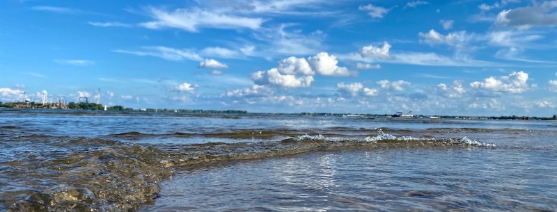
The New York Lakes Seaway Trail is a scenic byway that follows the shoreline of Lake Erie, the Niagara River, Lake Ontario, and the St. Lawrence River in upstate New York. It covers approximately 518 miles and passes through over 200 communities, including historic sites, state parks, and recreational areas. The byway highlights the natural beauty of the region and the unique cultural and historical heritage of the communities along the way.
This New York Seaway trip itinerary includes a visit to the Thousand Islands, a region of over 1,800 islands in the Saint Lawrence River. Here, you can take a boat tour and explore the many islands, including Boldt Castle, a beautiful 19th-century mansion. After exploring the Thousand Islands, you can cruise on Lake Ontario, the largest lake in the region. You can take in the stunning views of the lake and the nearby towns and villages. If you’re looking for a more active vacation, consider a kayaking or canoeing trip on one of the many lakes in the area. There are also plenty of hiking trails to explore, and you can even take a guided tour of the area’s wildlife.
New York Lakes Seaway Day 1
Start: Tour Beginnings – Albany
The New York Nature tour recommends flying into New York City and reserving three days to explore the Big Apple, then taking a day-long trip winding up the Hudson Valley towards Albany. Plan on visiting Bear Mountain State Park; tour Sunnyside, the home of author Washington Irving; or visit Val-Kill, Eleanor Roosevelt’s home. Spend the night in Albany, New York.
Stop 1: Waterford Harbor Visitor Center
Directions From Albany:
- Follow Interstate 787 northwards.
- Continue straight northward after the Interstate ends and becomes State Route 787, then turn right onto State Road 32.
- Continue along State Road 32 for 1.7 miles, then turn right onto 3rd Street.
- From 3rd Street, turn left onto South Street and then right onto Tugboat Alley. The Welcome Center will be at the end of Tugboat Alley.
The Waterford Canal Harbor Welcome Center is a tourist information center in Waterford, New York, USA. The center provides visitors with information about the Erie Canal, local attractions, events, and accommodations. Knowledgeable volunteers are happy to help visitors with questions and recommend things to see and do in the area.
- Distance from Albany: 12 miles / 19.2 km
- Travel Time from Albany: 20 minutes
- Suggested Time at This Site: 45 minutes
A new interpretive sign indicates the junction of New York’s three major heritage corridors – the Hudson River National Heritage Corridor, the Mohawk Valley Heritage Corridor, and the Lakes to Locks Passage.

Stop 2: Slate Valley Museum
Directions From Tug Boat Alley:
- Go north to the intersection of South Street.
- Turn left on South Street.
- Turn right onto 3rd Street, which will become Highway 4.
- Continue along Highway 4 for 51.7 miles through Mechanicville, Schuylerville, Hudson Falls and Fort Ann to the junction of State Road 22.
- Go 9.8 miles on State Road 22, and turn left onto Mettowee Street.
- Continue along Mettowee Street for .8 miles.
- Turn right onto Glen Street.
- Turn left onto Main Street.
- Turn right onto River Street, and continue to the Slate Valley Museum.
While the Slate Valley Museum may not be for everyone, it is a unique museum that offers visitors an opportunity to learn about the history and cultural significance of the slate industry in the United States. The museum is located in Granville, New York, once a significant center for slate production in the country.
At the museum, visitors can explore exhibits that showcase the history of slate mining and production, including displays of tools and equipment used in the industry. The museum also features exhibits on the geology of slate, the art and architecture of slate, and the cultural and social impact of the industry on the region and the country as a whole.
- Distance from Previous Site: 64 miles / 102.4 km
- Travel Time from Previous Site: 1 hour 40 minutes
- Suggested Time at This Site: 30 minutes
The Slate Valley Museum celebrates the rich heritage of the Slate Valley in New York and Vermont. Museum exhibits and programs interpret the geology of slate, the history of quarrying, and the Welsh immigrant culture evident in the local communities.

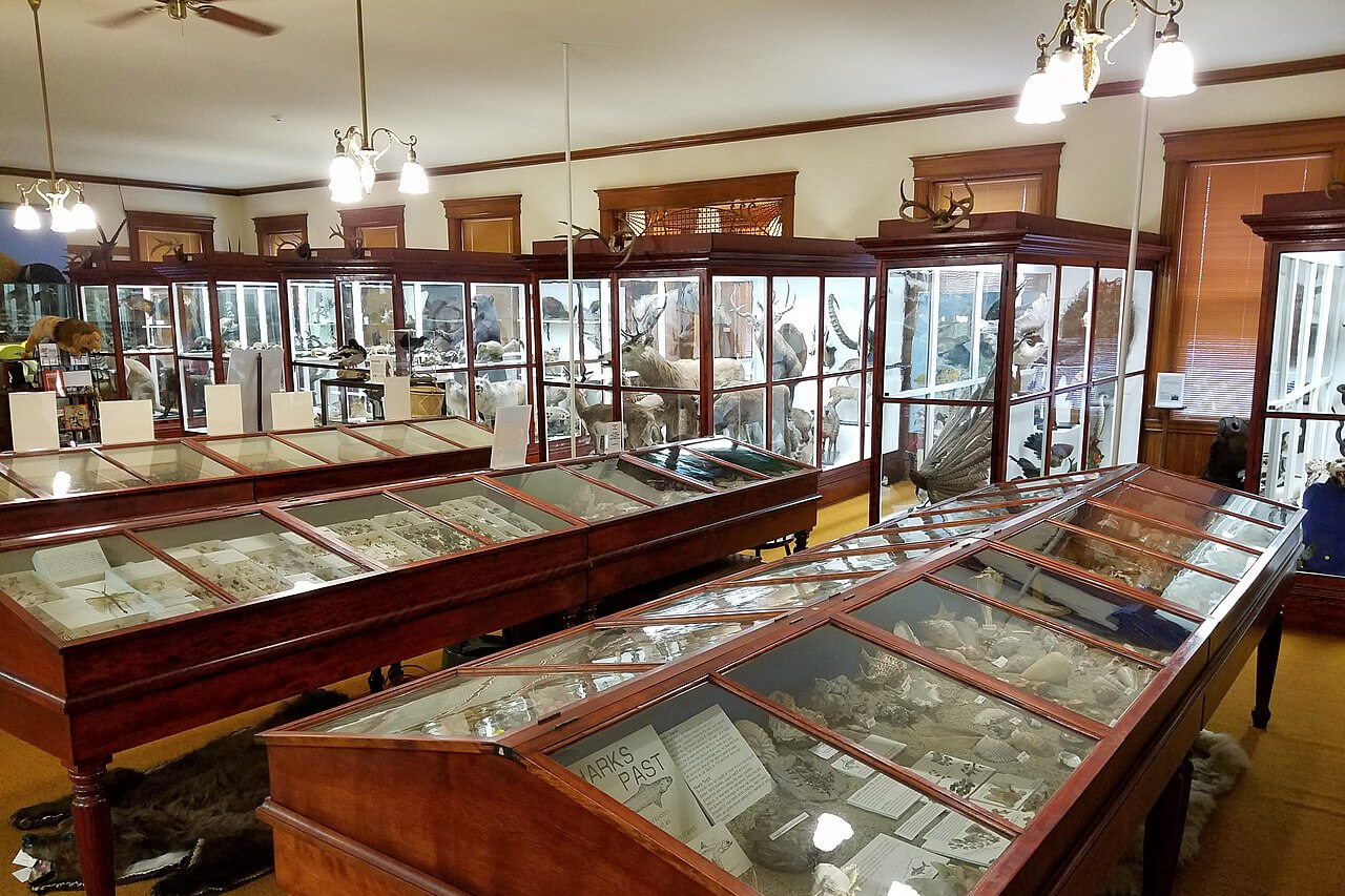
Stop 3: Pember Museum
Directions From the Slate Valley Museum: head north towards Main Street. Turn left onto Main Street, and continue to 33 West and the Pember Museum.
- Distance from Previous Site: 0.25 miles / 0.4 km
- Travel Time from Previous Site: 2 minutes
- Suggested Time at This Site: 30 minutes
The Pember Museum is a natural history collection of mounted birds and mammals, bird nests and eggs, insects, plants, shells, rocks, and minerals. The Pember Library and Museum were established in Granville, New York, in 1909, by Franklin Tanner Pember and his wife, Ellen Wood Pember. Both institutions continue to operate in the marble structure designed and built for this purpose.
In 1979, the Pember Museum acquired 125 acres of land south of Granville, which became the Pember Nature Preserve. The Pember Museum of Natural History and the Pember Nature Preserve provide programs, exhibits, and activities for the people of eastern New York and western Vermont. It is the only institution in the region and offers lectures, field trips, environmental studies, tours, hikes, day camps, outreach, and many other special programs.
Stop 4: Fort Ticonderoga
Directions From the Pember Museum:
- Head southwest on Main Street.
- Bear right onto Quaker Street.
- Turn left onto Mettowee Street and continue for .6 miles.
- Turn right onto State Road 22 and continue for 3.3 miles.
- Turn right onto County Road 12A, and then turn right onto County Road 12 and continue for 9 miles
- Turn left onto Poultney Street, and then veer right onto Broadway, or State Route 22.
- Continue for 24.8 miles along State Route 22.
- Turn right onto State Route 74, where you will find the entrance to Fort Ticonderoga.
This restored 18th Century fort resides on 2000 acres and features museum exhibits and educational programs that focus on the military history of the Lake Champlain and Lake George regions. Visitors enjoy breathtaking views of Lake Champlain, the Adirondacks, and the Green Mountains from the fort. This historic fort still relives a history of pivotal battles and strategic wars that played a part in forming the American, Canadian, and European nations. If you pass through on Labor Day or at the end of June, you may catch a spectacular re-enactment of battles from the Revolutionary War or the French and Indian War.
- Distance from Previous Site: 40 miles / 64.0 km
- Travel Time from Previous Site: 1 hour 8 minutes
- Suggested Time at This Site: 1 hour 30 minutes

End: Lake Placid
Directions from From Fort Ticonderoga:
- Head north, then turn left onto State Route 74 and continue for 1.2 miles.
- Turn right to continue along State Route 22/74 for 18.8 miles.
- Merge onto I-87 Northbound.
- Take Exit 30 and then turn left onto US 9. Continue for 2.2 miles
- Turn slightly left onto NY-73 and continue for 27.5 miles into Lake Placid.
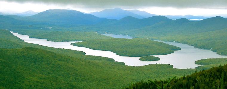
You will spend your first night in Lake Placid. Lake Placid has hosted two Winter Olympics and is a major recreational center in the Adirondacks, with a year-round operating ski resort. Lake Placid features excellent accommodations, so call ahead for reservations.
- Distance from Previous Site: 66 miles / 105.6 km
- Travel Time from Previous Site: 1 hour 19 minutes

Totals for Day 1 Summary
- Total Distance Traveled: 182.25 miles / 291.6 km
- Total Travel Time: 4 hours 29 minutes
- Total Stopping Time: 3 hours 15 minutes
New York Lakes Seaway Day 2
Stop 1: Alexandria Bay
Directions From Lake Placid:
- Head south on NY-73 toward Adirondack Loj Road.
- After about 8 miles, turn right onto NY-86 West.
- Continue on NY-86 West for about 45 miles until you reach Paul Smiths.
- In Paul Smiths, turn left onto NY-30 South.
- Follow NY-30 South for about 27 miles until you reach Tupper Lake.
- In Tupper Lake, turn right onto NY-3 West.
- Continue on NY-3 West for about 68 miles until you reach Alexandria Bay.
- Once in Alexandria Bay, follow the signs to your desired destination.
Locate your accommodations and prepare for an excellent time on the Great Lakes Seaway Trail. You will spend the next two nights in Alexandria Bay, in the 1000 Islands region of northwestern New York. Alexandria Bay is a central location on the Great Lakes Seaway Trail, second America’s Byway of our tour. Check into your accommodations.
- Distance from Previous Site: 136.09 miles / 217.7 km
- Travel Time from Previous Site: 3 hours
- Suggested Time at This Site: 30 minutes

Stop 2: Boldt Castle
Directions from Alexandria:
Navigate from your lodgings to Church Street. Follow Church Street northwest to the docks on the St. Lawrence River. Here you can find several boat tour operators willing to take you to Heart Island, the home of Boldt Castle
- Distance from Previous Site: 1 miles / 1.6 km
- Travel Time from Previous Site: 15 minutes
- Suggested Time at This Site: 2 hours
Looking like it dropped straight from the shores of Germany’s Rhine River, Boldt Castle is a magnificent six-story island castle in the heart of the Thousand Islands area. In 1900, a millionaire named George C. Boldt went to work building a castle with over 120 rooms for his wife, Louise. Yet the fantasy castle was not to be. When Louise died shortly after the work commenced, George lost all interest in the castle and it was abandoned.
Seventy years later, the Thousand Islands Bridge Authority acquired the property and restored and improved the structure. The first level of the castle is now a museum, filled with exhibits dedicated to the lives of George and Louise Boldt and the development of the Thousand Islands region.

End: Alexandria Bay
After your tour, return to your choice of lodging and rest for the next day.
- Distance from Previous Site: 1 mile / 1.6 km
- Travel Time from Previous Site: 15 minutes
Totals for Day 2
- Total Distance Traveled: 138.09 miles / 220.9 km
- Total Travel Time: 3 hours 30 minutes
- Total Stopping Time: 2 hours 30 minutes
New York Lakes Seaway Day 3
Stop 1: Antique Boat Museum
Directions from Alexandria:
- Navigate to State Route 12 or the Great Lakes Seaway Trail.
- Head east along the Great Lakes Seaway Trail for 11 miles to reach State Street in Clayton.
- Turn right onto Alexandria Street and then left onto Mary Street.
- The Antique Boat Museum is located at 750 Mary Street.
Situated on one of the loveliest harbors in the 1000 Islands, the Antique Boat Museum offers the whole family a perfect setting for summer fun. Experience a priceless collection of over 200 antique boats, take a quiet ride in a St. Lawrence Skiff, or thunder down the River in a gleaming mahogany runabout. Round out your visit by browsing the River Memories Gift shop and consider enrolling in a boat building or restoration class.
- Distance from Previous Site: 11.72 miles / 18.8 km
- Travel Time from Previous Site: 20 minutes
- Suggested Time at This Site: 1 hour 30 minutes

Stop 2: Great Lakes Seaway Trail Discovery Center
Directions From the Antique Boat Museum:
- Head southwest on Mary Street and turn left onto Theresa Street.
- Turn right onto State Street (State Route 12), part of the Great Lakes Seaway Trail.
- Continue to follow State Route 12 for 31 miles, passing through Cape Vincent.
- Turn right onto State Route 180 and continue for 5 miles.
- Take a slight right onto State Route 3 and continue for 2.5 miles.
- Turn right onto Sulphur Springs Road, and continue for 1.4 miles into Sacketts Harbor.
- The Great Lakes Seaway Trail Discovery Center is on the corner of Ray Street and West Main Street.
The Great Lakes Seaway Trail Discovery Center is an authoritative introduction to any visit. Interactive exhibits highlight the many cultural and historic activities along the trail. You can command at a tall ship’s wheel, test your knowledge of War of 1812 trivia, and view one-of-a-kind murals.
Several characters enhance your visit to the Great Lakes Seaway Trail. An animated Ulysses S. Grant, who played checkers in this building as a young officer, greets you at the entrance. You can chat with lake and salmon anglers about fishing or visit the Great Lakes Seaway Trail Talking Cow to learn about the many fresh farm products available along the Great Lakes Seaway Trail.
- Distance from Previous Site: 41 miles / 65.6 km
- Travel Time from Previous Site: 1 hour
- Suggested Time at This Site: 1 hour 30 minutes
After exploring the Discovery Center, return to your lodgings at Alexandria Bay.

Back to Alexandria Bay
Directions From the Great Lakes Seaway Trail Discovery Center:
- Head east on NY-3 E/State Route 3 E.
- After approximately 8 miles, turn right onto NY-12E.
- Follow NY-12E for approximately 17 miles.
- Turn left onto NY-26E and continue for approximately 27 miles until you reach Alexandria Bay.
- Once in Alexandria Bay, follow the signs to your desired destination.
Extra Sights and Stops Along the Way:
- Cape Vincent: This small town on the shores of Lake Ontario offers scenic views of the lake and access to several parks and beaches.
- Tibbetts Point Lighthouse: Located on the point of land in Cape Vincent, this historic lighthouse offers tours and scenic views of Lake Ontario.
- Clayton: This charming village on the St. Lawrence River is home to several shops, galleries, and restaurants, as well as the Antique Boat Museum.
- Thousand Islands Bridge: This bridge spans the St. Lawrence River between the United States and Canada and offers stunning views of the Thousand Islands region.
Return to your lodgings at Alexandria Bay.
- Distance from Previous Site: 40 miles / 64.0 km
- Travel Time from Previous Site: 45 minutes
Totals for Day 3 Summary
- Total Distance Traveled: 92.72 miles / 148.4 km
- Total Travel Time: 2 hours 5 minutes
- Total Stopping Time: 3 hours
New York Lakes Seaway Day 4
Stop 1: Fort Ontario
Directions from Alexandria Bay:
- Navigate to State Route 26, and then head south for 4 miles.
- Merge onto Interstate 81, and continue for 64 miles.
- Take Exit 34.
- Turn right onto State Route 104, and continue for 21 miles into Oswego.
- Turn left onto 4th Avenue, and continue to the Fort Ontario State Historic Site.
Fort Ontario has played many changing roles throughout history and through a series of wars. Throughout the French and Indian War and the Revolutionary War, Fort Ontario was built and destroyed several times. Beginning as a simple log stockade, the fort evolved into its current star shape decades after the War of 1812. From 1944 to 1946, the fort also housed refugees from the WWII Holocaust. The fort features living history exhibits, including an array of historical information and artifacts.
- Distance from Previous Site: 90 miles / 144.0 km
- Travel Time from Previous Site: 1 hour 40 minutes
- Suggested Time at This Site: 45 minutes

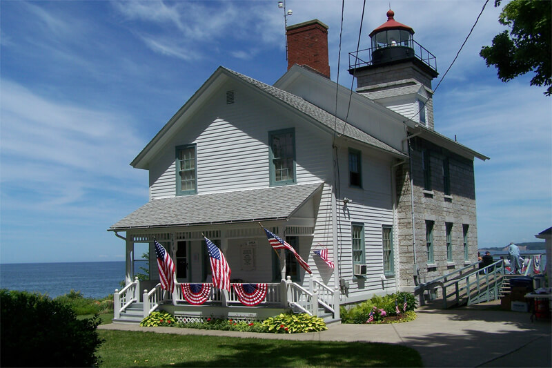
Stop 2: Old Sodus Lighthouse
Directions From Fort Ontario:
- Follow 4th Avenue northwest and turn left onto W. Seneca Street, State Route 104 W, or the Great Lakes Seaway Trail.
- Continue along State Route 104 W for 14.7 miles until you reach the community of Fair Haven.
- Continue 6.2 miles south of Fair Haven on Route 104 A, and then turn right onto Route 104.
- Continue on Route 104 for 2.7 miles.
- Turn right onto Ridge Road and continue for 1.6 miles.
- Take a slight right to continue along Ridge Road for another 6.8 miles.
- Turn right onto Shaker Tract Road, continue for 3 miles.
- Turn right onto State Route 14 and continue for nearly 3 miles to the Old Sodus Lighthouse.
- The Old Sodus Lighthouse is located at 7606 N Ontario Street.
The Sodus Point Lighthouse provides incredible views of Lake Ontario and the Chimney Bluffs from its lantern room, and the keeper’s house doubles as a museum. Since the mid-1800s, Sodus Bay and the lighthouse have been ideal places for yachtsmen, campers, fishermen, and picnickers to enjoy summer activities.
- Distance from Previous Site: 40 miles / 64.0 km
- Travel Time from Previous Site: 1 hour 24 minutes
- Suggested Time at This Site: 30 minutes
Stop 3: Charlotte-Genesee Lighthouse
Directions from Sodus Lighthouse:
- From Sodus Lighthouse, head west on N. Ontario St. toward Mill St.
- Turn left onto Mill St.
- Continue straight onto Ridge Rd. E.
- After approximately 12 miles, merge onto NY-104 W via the ramp to Rochester.
- Follow NY-104 W for approximately 17 miles.
- Take the exit toward Lake Ave./Beach Ave.
- Turn left onto Beach Ave.
- Continue straight onto Lake Ave.
- Turn left onto Boxart St.
- Turn right onto River St.
- Continue straight onto Lighthouse Rd.
- Charlotte-Genesee Lighthouse will be on your left.
The original Charlotte-Genesee Lighthouse was built here in 1822 and is the second oldest lighthouse on the Great Lakes. Nearly 200 years after it was built, the lighthouse was restored and converted into a museum. Many historic structures still exist on the same grounds as this lighthouse in Rochester.

- Distance from Previous Site: 40.86 miles / 65.4 km
- Travel Time from Previous Site: 1 hour 15 minutes
- Suggested Time at This Site: 30 minutes
End: Rochester
After visiting the Charlotte-Genessee Lighthouse, proceed to your lodgings in Rochester or take in one of the attractions near the Charlotte-Genesee Lighthouse in Rochester, New York.
- Ontario Beach Park – a popular recreational area on the shores of Lake Ontario with a boardwalk, beach, playground, and picnic areas.
- Charlotte Pier and Marina – a historic pier and marina that offers fishing opportunities and beautiful views of the lake and city skyline.
- Seneca Park Zoo – a popular zoo featuring a wide variety of animals, including lions, elephants, and penguins.
- High Falls – a scenic waterfall in the center of downtown Rochester, surrounded by historic buildings and a walking bridge.
- Memorial Art Gallery – an art museum that features over 11,000 works of art, including paintings, sculptures, and decorative arts.
Totals for Day 4
- Total Distance Traveled: 170.86 miles / 273.4 km
- Total Travel Time: 4 hours 19 minutes
- Total Stopping Time: 1 hour 45 minutes
New York Lakes Seaway Day 5
Stop 1: George Eastman Museum
Directions from previous place: From your lodgings in Rochester, navigate to 900 East Avenue. The George Eastman House will be on the north side of the street.
What was once the home of George Eastman, founder of Eastman Kodak, this Georgian-revival mansion contains the world’s preeminent photography museum and one of the oldest film archives in America. Learn about the history of photography, or watch a film preserved from the early 20th Century.
- Distance from Previous Site: 5 miles / 8.0 km
- Travel Time from Previous Site: 20 minutes
- Suggested Time at This Site: 1 hour
Stop 2: Strong Museum & National Toy Hall of Fame
Directions from previous place: From the George Eastman Museum, turn right and head west on East Avenue for 0.9 miles. Turn left onto Pitkin Street, and continue for 0.4 miles. Make a slight right onto Monroe Avenue, and then turn right onto Manhattan Square Drive. The Strong Museum is located at 1 Manhattan Square Drive.
- Distance from Previous Site: 1.5 miles / 2.4 km
- Travel Time from Previous Site: 5 minutes
- Suggested Time at This Site: 1 hour 30 minutes
The Strong Museum features 500,000 objects dealing with everyday American life, including historic toys and games, home crafts, and even advertisements. The museum also houses the National Toy Hall of Fame.
End: Rochester, Second Day
After visiting the Strong Museum, spend the day experiencing the sights, sounds, and shops of Rochester. For more information on things to do in Rochester, visit the Rochester Downtown site. Return to your lodgings after your second day in Rochester.
Totals for Day 5
Total Distance Traveled: 6.5 miles / 10.4 km
Total Travel Time: 25 minutes
Total Stopping Time: 2 hours 30 minutes
New York Lakes Seaway Day 6
Stop 1: Thirty Mile Point Lighthouse
Directions From the Rochester City Center:
- Head east on E. Main St. toward Exchange Blvd.
- Turn left onto State St./NY-383.
- Follow State St./NY-383 for approximately 6 miles.
- Turn right onto Culver Rd./NY-590 N.
- Follow NY-590 N for approximately 11 miles.
- Take the exit toward Lake Ontario State Pk/Waterport.
- Turn left onto Lake Rd./NY-18.
- Follow NY-18 for approximately 15 miles.
- Turn right onto Point Breeze Rd./County Rd. 78.
- Follow County Rd. 78 for approximately 3 miles.
- Turn left onto Lighthouse Rd.
- Thirty Mile Point Lighthouse will be on your right.
Thirty Mile Point Lighthouse is a great photo opportunity in Golden Hill State Park. As visitors explore the park and walk around this 1875 lighthouse, the life and times of a lighthouse come into view through informational signs. During its years of operation, a lighthouse keeper lived in it to attend to its maintenance. The lighthouse keeper would light the wick, make sure there was sufficient oil, trim the wick, and polish the lens of the light. Other buildings around Thirty Mile Point Lighthouse include a foghorn building, a carriage house, outhouses, and oil houses.
- Distance from Previous Site: 59 miles / 94.4 km
- Travel Time from Previous Site: 1 hour 11 minutes
- Suggested Time at This Site: 30 minutes
Stop 2: Old Fort Niagara
Directions from previous place:
From Thirty Mile Point Lighthouse:
- Head west on Lower Lake Road.
- Turn left onto Carmen Road and continue for 1.2 miles.
- Turn right onto Lake Road and continue for 26.3 miles.
- Turn right onto Robert Moses State Parkway and continue for 2.1 miles.
- Take the NY-18/Fort Niagara ramp and merge onto Robert Moses State Parkway. Continue for 1 mile.
- Enter next roundabout and take 2nd exit. Continue for .5 miles.
- Turn slight right onto Scott Avenue, then continue to the entrance of Old Fort Niagara.
Under three different flags, Old Fort Niagara stood for over 200 years. The French recognized the importance of the location and built temporary forts here as early as 1678 under La Salle. In 1726, the actual Old Fort Niagara, which stands today, was created by the French and was a key location for fur traders. The fort bothered Great Britain, who wanted to control this settlement. In 1759, after an 18–day siege, the fort was surrendered to the English, who improved it and continued to use it in the fur trade. It was used as a base for launching attacks in New York during the American Revolution. However, Great Britain relinquished the fort to the fledgling United States after the American Revolution. Great Britain would reclaim the fort temporarily during the War of 1812, but the United States again took control following the war.
- Distance from Previous Site: 32 miles / 51.2 km
- Travel Time from Previous Site: 48 minutes
- Suggested Time at This Site: 1 hour
End: Niagara Falls
Directions From Old Fort Niagara:
- Go southeast on Scott Avenue for .7 miles.
- Turn slight right onto Main Street and continue for 5.5 miles. Main Street will become Lower River Road.
- Turn left onto Oneida Street.
- Turn right onto N 4th Street.
- Turn left onto Center Street and continue for 0.7 miles.
- Take the Route 104-W ramp towards I-190 and Canada. Continue for .2 miles.
- Turn slight right onto Lewiston Road and continue for 5.1 miles.
- Turn right onto Main Street and continue into Niagara Falls.
Spend the next two nights of your trip in Niagara Falls, a city full of history, nature, and excitement.
- Distance from Previous Site: 9 miles / 14.4 km
- Travel Time from Previous Site: 20 minutes
Totals for Day 6
- Total Distance Traveled: 100 miles / 160.0 km
- Total Travel Time: 2 hours 19 minutes
- Total Stopping Time: 1 hour 30 minutes
New York Lakes Seaway Day 7
Stop 1: Niagara Falls State Park
Directions: Make your way from your lodgings to Niagara Falls State Park, which spans the Niagara River near Rainbow Bridge.
Suggested Time at This Site: 12 hours
Once believed to be the sacred dwelling place of the Native American Thunder Being “Henon”, Niagara Falls is now a cultural icon. For decades, people have made it their vacation destination. The falls consist of two parts: the American Falls and Horseshoe Falls. The American Falls is on the U.S. side, while the U.S. and Canada share Horseshoe Falls. Horseshoe Falls is the widest at 2200 feet, but the American Falls are the taller at 184 feet. The two combine to form a grand spectacle of water gushing off the cliffs, creating a foamy whiteness the color of snow.

Visitors gather at overlooks on Goat Island or tour under the falls themselves. The Maid of the Mist is a boat that will take visitors close to the bottom of the falls. Take a long look at the falls from overlooks on Goat Island, or take a tour under the falls themselves. The Maid of the Mist is a boat that will take visitors close to the bottom of the falls. Visit the visitor center, gardens, gift shops, restaurants, and the Niagara Falls aquarium. Then, once night has fallen, see the falls lit up in a spectacular light show.
End: Niagara Falls, Second Night
After a full day at Niagara Falls State Park, return to your lodgings for the night.
Totals for Day 7
- Total Distance Traveled: 0 miles / 0.0 km
- Total Travel Time: 0 minutes
- Total Stopping Time: 12 hours
New York Lakes Seaway Day 8
Stop 1: Harriet Tubman’s Home
Directions from Niagara Falls:
- Follow I-190 S to the junction of I-290 E.
- Take Exit 16 towards Tonawanda and Rochester, and continue for 10 miles.
- Take Exit 1-49 on the left to merge onto I-90 E.
- Continue along I-90 for 100 miles.
- Take Exit 41 toward Seneca Falls.
- Turn slight right onto Ridge Road.
- Turn left onto NY-318 and continue for 4.1 miles.
- Turn slight left onto US-20 E / NY-5 E. Continue for 11.2 miles.
- Turn slight right onto Clark Street.
- Turn right onto Dill Street.
- Turn right onto South Street and continue for 1 mile to Harriet Tubman’s home at 180 South Street.
Visit the last home of Harriet Tubman, the famed worker on the Underground Railroad in the 1800s, in Auburn, New York.
- Distance from Previous Site: 139 miles / 222.4 km
- Travel Time from Previous Site: 2 hours 32 minutes
- Suggested Time at This Site: 30 minutes

Stop 2: William Seward House
Directions From Harriet Tubman’s Home: Head a mile south on South Street to 33 South Street, the location of the Seward House.
Visit the home of William Henry Seward, who served as Governor of New York, United States Senator, and Secretary of State to Presidents Lincoln and Johnson. The guided tour includes Civil War Era memorabilia.
- Distance from Previous Site: 1 miles / 1.6 km
- Travel Time from Previous Site: 3 minutes
- Suggested Time at This Site: 30 minutes

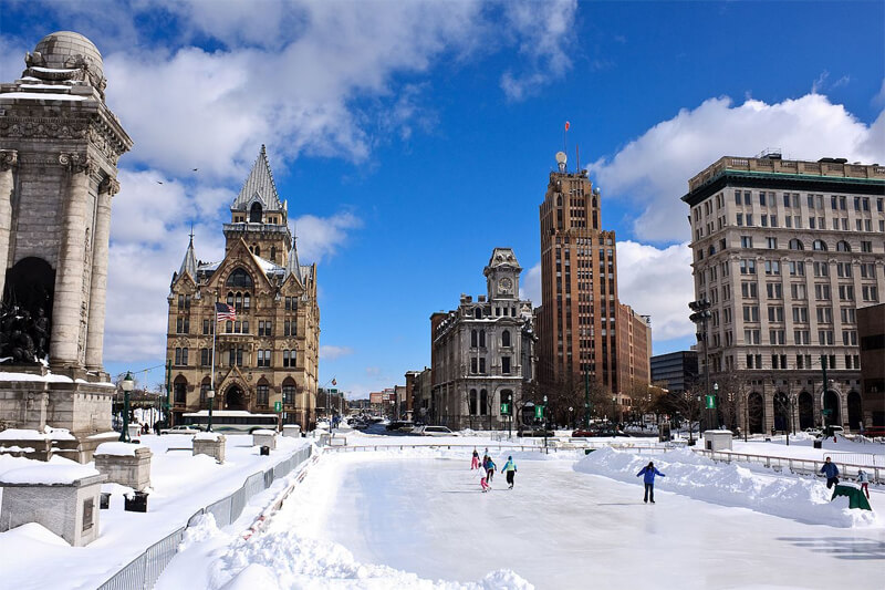
End: Syracuse
Spend the rest of your day in the Syracuse area. You can tour the Museum of Automobile History, visit the grounds of Cornell University, or rent a boat and go boating on beautiful Cayuga Lake.
Syracuse, New York, has a variety of attractions that may be of interest. Here are some examples:
- Onondaga Lake Park – A beautiful park with walking trails, fishing piers, and picnic areas. It also hosts concerts and events during the summer.
- Everson Museum of Art – This museum has an impressive collection of American art and contemporary works. It also features special exhibitions and events throughout the year.
- Erie Canal Museum – A museum that tells the story of the Erie Canal, which played a crucial role in the development of Syracuse and New York State.
- Rosamond Gifford Zoo – A famous zoo including lions, tigers, and penguins.
- The Milton J. Rubenstein Museum of Science and Technology (MOST) is a science museum with interactive exhibits on astronomy, physics, and engineering topics.
- The Museum of Intrigue – An interactive museum that presents immersive experiences and escape room games.
- The Syracuse Nationals Classic Car Show – A popular car show that takes place annually in July, showcasing classic and vintage cars.
Totals for Day 8
- Total Distance Traveled: 140 miles / 224.0 km
- Total Travel Time: 2 hours 35 minutes
- Total Stopping Time: 1 hour