The earth can be raw, devastating, and even beautiful in its relentlessness.
Ponder its great rivers. Waters flow where waters will flow. We can dam, dredge, and reinforce to our heart’s delight, but when the aquifers are full and the rain still falls, there is often little we can do to contain a breaching canal. But whereas most people think of aqueous overkill when pondering Mother Earth’s tempestuous majesty, there is an arid and equally fluid opposite pole that will not be denied: deserts.
Deserts are areas of light rainfall with little or no plant or animal life. Moviegoers love them as vast sweeps of rolling ochre dunes and cracked flatlands. But not all deserts are sere, sand-swept Saharas; limited precipitation can also be the result of extreme cold, like that found in Antarctica, one of the driest places on the planet. And then there is the human element: Even in more temperate climates, overgrazing, inefficient irrigation, and deforestation can prompt desertification.
Here, then, is GORP’s look at ten of the world’s “best” deserts (in no particular order). Why contemplate barren austerity? Because trekking, galloping, pedaling, and driving into the uninviting emptiness of our earth’s least hospitable climes is part of the outdoor package people now seek. Besides, what better place is there to go to when you want to get away from it all. Not just some of it, but ALL!
Sahara Desert
Proud and supreme monarch of all aridity, the Sahara, a name derived from the Arabic word for “deserts,” is as daunting to describe as it is to behold. More than 3,000 miles from east to west across the full length of northern Africa and 800-1,200 miles from north to south, its almost 3.5 million square miles make it by far the largest desert in the world. It may also be the hottest; the world’s highest recorded temperature was suffered in the Libyan desert in 1922: 136 degrees F. Topographically very varied—with seasonal water basins, numerous eastern oases, enormous gravel-covered plains, rocky plateaus, mountains rising 11,000 feet above sea level, and sand sheets and dunes (the latter covering almost 25 percent of its surface)—it has changed little in human terms: It is as limitless and imposing as it was when the Pharaohs ruled. Nevertheless, in a classically human attempt to plant a footprint on every inch of the earth’s surface, exploration into and commerce across this scorched earth has been carried on since Carthaginian times. Today, the accessible parts of it are staging grounds for endurance adventure challenges such as marathon-length foot races and motorized rallies.
Kalahari Desert
Africa’s “other” great desert, the giant Kalahari, should not be written off just because it is the next-door neighbor of the Sahara. A grand and elevated (always more than 3,000 feet above sea level) interior plain that covers most of Botswana, huge swaths of Namibia, and a part of northern South Africa, the Kalahari extends for more than 360,000 square miles. The mostly featureless, gently rolling surface is blanketed by red (iron oxidized) sand that can reach depths of over 200 feet! The Kalahari was once much wetter than it is today. Pans, or “dry lakes,” are evidence of this. Water once flowed into landlocked depressions where evaporation has left only the mineral and salt-rich silt. These sun-baked basins glow a blinding white. Since the mid-1970s, improved car access has opened the Kalahari’s gleaming serenity to tourism and study.
North American Desert
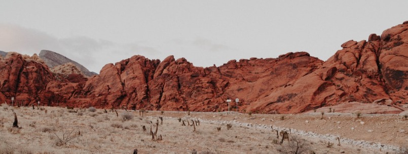
The North American Desert is composed of the Mojave, Sonoran, Great Basin, and Chihuahuan deserts. The Mojave Desert and Death Valley are probably the best known of its parts. The Mojave covers more than 25,000 square miles, including mountains, sand and gravel basins, and salt flats, and is characterized by great changes in temperature. Although rainfall is limited, cattle grazing is common in the north and urban development (especially in the southwest, around Los Angeles) is pushing plumbing further into the fringes. The Mojave’s most famous population center is Las Vegas, Nevada. Joshua Tree National Park also sits in the desert’s sere cactused midsts. Once a devastating obstacle to pioneers and westward expansion, the lowest (282 feet below sea level), hottest (134 degrees F is the highest recorded temperature) and driest point in the United States, Death Valley is now a point of attraction. Declared a national monument in 1933 and a national park in 1994, Death Valley’s good roads, ghost towns, campgrounds, education tours, and much more keep drawing people in.
Atacama Desert
The Desierto de Atacama is the driest desert in the world and completely devoid of plant life. Located in northern Chile, the Atacama is mostly salt pans (dry lakes) at the foot of the coastal mountains. There are some sandy dunes, but rocky reaches are more common. The Atacama Desert is part of the dry western shoreline of South America, although much more dramatic. A combination of cold currents and unique geography make rainfall highly uncommon. The city of Calama, for example, has never received rain since records have been kept. Atacama is a cool desert, with average summer temperatures in some towns rarely getting above 70 degrees F. Despite the paucity of rainfall, there is some farming including lemons (at Pica), potato and alfalfa (at Calama, watered by the Loa River), and a variety of products along the salty shores of the marshes at San Pedro de Atacama.
Tibetan Highlands
The Highlands of Tibet is more a high plateau than they are a desert. Wrapped in knots of mountains rising 13,000-15,000 feet above sea level, they are regal desolation exemplified. Everywhere here at the thin heights of southeastern China, water gives way directly to sand, sand to rock, and rock to snow. Forbidding elements. Proud Tibetan people have populated this plateau long enough to be part of the land and reflect its quiet poise. Muddy villages—foremost among them the magical capital city of Lhasa—of squat white-washed homes and clay red-painted Buddhist temples keep to the low southern and eastern plains where the Upper Indus, Brahmaputra, Yangtze, Huang Ho, Mekong, and other rivers have their headwaters, the first two spilling early into wide fertile valleys. The broad northern expanse is far less hospitable, especially the Tsaidam Basin, a dry wasteland of gravel, sand, and clay. A visit to the plateau—thought of more as a visit to Tibet—is unforgettable.
Central Asian Steppe Deserts
Like the Tibetan Highlands, the Central Asian Steppe isn’t quite a desert. Lost in the remote hinterlands of the Eurasian continent and once heavily forested, the steppe has seen centuries of cultivation and overgrazing by animals. It is today a barren landscape of dry, short-grass plain. But dry-land scouts need not be disappointed; in more than one place, spotty vegetation gives way to full-fledged desert. In the west and broken by mountain ranges (the slopes of which are often incongruously green and fertile), the low-lying Karakum and Kyzylkum Deserts start an arid stretch that reaches east to the Takla Makan and Gobi Deserts. The Karakum and Kyzylkum Deserts of Turkmenistan, Kazakhstan, and Uzbekistan are wind-carved and peppered with sand ridges. The Gobi and Takla Makan Deserts, broad, barren, sandy and rocky plains, are further east, where China and Mongolia meet. In Mongolian, “gobi” means “waterless place.” Add to that “sandless” and the image of hardened bare rock dropping off into the horizon in all directions and you have an idea of the Gobi. The Takla Makan, by contrast, is one of the largest sandy deserts in the world, famous for its swiftly moving dunes. Long considered secluded and hazardous, these deserts, once on the edge of the Silk Road, have seen new notoriety with renewed interest in adventure travel.
Syrian and Arabian Deserts
Dominating the southwestern edge of the Asian continent, two deserts of distinctly different character are a formidable barrier between the Asian steppe and the Mediterranean. The Syrian Desert is an arid rocky wasteland covering northern Saudi Arabia, eastern Jordan, southern Syria, and western Iraq. Formed by lava flows, the rock and gravel steppe is utterly barren but crossed today by oil pipelines. In the south, a nomad-inhabited desert mountainous region known as Al-Hammad gives way to the great Arabian Desert. Famous in film as an endless blur of sand and terra cotta—colored plains, black lava flows, and red-tinted dunes, the Arabian Desert is unmistakable. Although hard to discern and despite the endless sand-swirling winds, there is life in this desert. Only the Rub’ al-Khali, Arabic for the “Empty Quarter,” is truly deserted. The largest uninterrupted sand-covered spread on the earth and one of the driest regions in the world, the Rub’ al-Khali occupies most of the central southern Arabian Peninsula. In 1948, Al-Ghawar, the world’s largest oil field, was discovered here.
Thar or Great Indian Desert
The wide 77,000-square-mile strip of rolling sand hills bridging the sensitive (often army-patrolled) southern Indian-Pakistani border is called the Thar (from “t’hul,” the word describing the sand ridges typical of the area) or Great Indian Desert. The most famous tourist gateway to this tract of accessible land is from the magical Arabian Nights city of Jaisalmer, on the western edge of India’s Rajasthan and within a camel’s trot of sand dunes. The traverse to the dunes is across variable terrain including sandy plains and low, sparsely vegetated hills. In typical fashion, warm days give way to comfortably cool star-filled evenings. Small villages cluster around oases and thin seasonal waterways.
Australian Outback
The interior of Western Australia comprises three nominally distinct but geographically interconnected deserts. The Great Sandy Desert, in the northwest, is covered in salt marshes and Spinifex sandhills. The Gibson Desert, just to its south, fills the central west. Most of this area is now the Gibson Desert Nature Reserve and protected home to many desert animals. Further to the south is the Great Victoria Desert, the eastern edge of which contains the Central and North West Aboriginal reserves. The Great Victoria Desert Nature Reserve, the Nullarbor National Park, and the Flora and Fauna Conservation Park are in this southern plot. At the eastern edge of the Great Victoria Desert, there are also large dune fields that extend into the often-visited Simpson Desert. Periodic rain in these and other arid areas runs off quickly to dramatic terrain-altering effect.
Antarctica
The driest continent on the planet is ironically the same one with 80 percent of the world’s drinking water locked up in it. Antarctica, contrary to common expectation, has very low water vapor levels, sees almost no rainfall, and is sometimes called the White Desert. The world’s lowest recorded temperature—-128.6 degrees F—made its mark here in 1983, although mean temperatures in the cooler months usually run from -4 degrees to -22 degrees F on the coast and from -40 degrees to -94 degrees F in the interior. If that were not bad enough, constant winds—capable of outrageous 100-mile gusts that pick up snow and redeposit it in no-new-precipitation “blizzards”—cool things down even more. Summer temperatures are usually about 60 degrees “warmer.” Ongoing studies in these pitiless conditions are helping scientists understand issues about the earth’s magnetosphere and the “ozone hole” discovered in 1971 but not made public until 1985.