Colorado Springs Climbing Pikes Peak
I’ve been looking up at Pikes Peak Colorado Springs for the past six years. Since moving to Colorado, that mountain has been the mountain that I have viewed out my window, on my drives, while I’m working. I’ve never wanted to pay over $20.00 for the privilege of driving up a 14er, so I have never been up there. Last summer I started climbing 14ers.
For those outside Colorado, a 14er is a mountain where the peak is above 14,000 feet above sea level. Last summer I climbed five different mountains. This summer, I want to climb 10. On Friday…I climbed one.
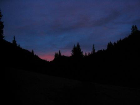
I left my house at about 5:15 am and drove over to the Crags Campground. (I used to live in Divide, CO.) The road was perfectly clear with no snow to be found. The weather has been quite warm for the past couple of weeks, so the snow is rapidly disappearing from these lower elevations. At around 5:40 am, I started out on the Crags Trail. Despite the fantastic directions provided by www.14ers.com, I missed the turn to Devils Playground. I was having too much fun getting outside after a long hiatus to pay attention. After about .5 miles, I realized my error and turned around. Let me just say…going the wrong way stinks.
After getting back to the turnoff, I starting going the right direction. In the trees, I found that there is still quite a bit of snow. I also found that because of people walking on the snow, and because of the melting and refreezing at night, the snow has turned into an ice skating rink. Thank goodness for my trekking poles. There were places where I just had to walk beside the trail because it was steep and very slippery. I walked on logs, and virgin snow and managed to make it to 11,000 feet.
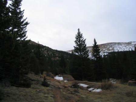
It is here that the crux of the trail lies. At this point, you are about to climb 2000 feet in about a mile. It starts with switchbacks up a steep slope through the trees. Fortunately, however, there was not much snow so I was able to just keep climbing.
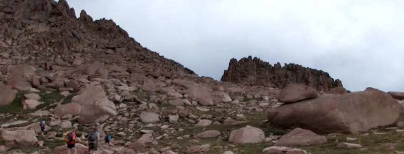
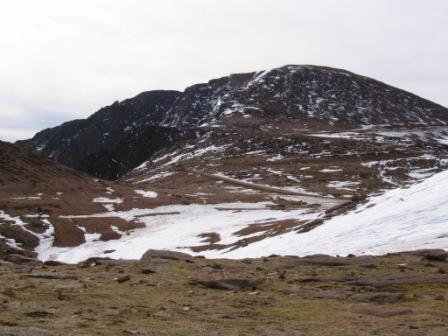
Above treeline, the trail turns and heads straight up the ridge toward the large snow patch covering the ridgeline. At the ridgeline, you are at about 13,000 feet. By this point in time, I was breathing pretty hard.
The views of some of the other mountain ranges in Colorado were worth the loss of breath.
Now I got a chance to catch my breath descending the ridge to Devils Playground. It is called Devils Playground because the lighting jumps from rock to rock during summer rainstorms.
At this point, I was in a relatively level section on this climb. There was minimal snow, but with 2.5 miles to go to the summit, it was still a fairly good hike to finish up. The peak looks like it is right there, but it is still a good ways off. At this point in time, the trail follows along the road that goes to Pikes Peak for ways. Because the snowplows have been out, the trail was actually buried under mounds of snow. I hiked up the hill and stayed above the snow and just made my own trail. I cut across the shoulder of the mountain and descended back to the road. By 9:30 AM, I had reached the road and was looking at the last stretch toward the peak. Here you have to walk to the left of the 13,000-foot peak and head toward the final 500 ft. climb up to the top.
So off I went, crossing the snow mass toward the peak. Fortunately, the footing was not too bad. I followed the cairns (piles of rocks) that directed me up the steep slope toward the top of the mountain. At one point I lost my way, so I just headed straight up to the best of my ability. I arrived at the Pikes Peak Colorado Springs at 11:00 am.
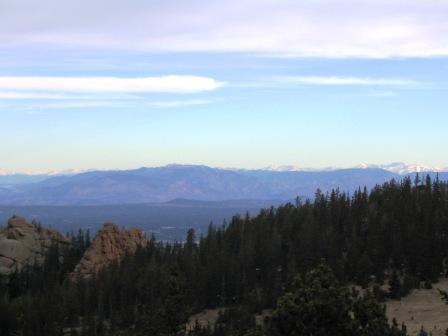
The views from Pikes Peak Colorado Springs are extraordinary. You can see the Garden of the Gods from the peak observation platform.
After spending about 1/2 hour at the top, I turned around and headed back for the car. At one point I post holed (sunk to my thigh in snow) and got a cramp in my right calf. I quickly pulled my leg out and worked out the cramp. The distance to the back to the car always seems to take forever. Working my way back down the long slope from the ridge, I could not believe how high it felt like it was.
This was a beautiful hike, there was not much snow, and I got back to my car by about 2:30 pm. Then I went home and collapsed. The first 14er of 2006 is completed. I’m sitting here looking at the peak and I love that I climbed it. This is the first of many. Every time I climb a mountain, I have to remember to just take one step at a time, keep moving, and I will make it.
You can do it too! If you are going to climb a peak, don’t forget your safety.
The Classic Barr Trail
The Barr Trail has the highest elevation gain of any trail in Colorado, so it is not for the weak of will. You gain 7400 vertical feet over 13 miles (one way).
I hiked the Barr trail to Pikes Peak in 2009. He was 10 years old. The trailhead starts at 6720 feet. The beginning of the climb is brutal with over 3 miles of switchbacks. It can be hot and very tiring. You have a long way to go, so take it slow.
Drink lots of water.
It can be a lot colder up high, so be prepared with extra layers of clothes. It snowed on us in the first week of August. Thunderstorms are common. Be prepared for afternoon rain and watch out for lighting.
Here is the description from the Trails and Open Spaces Coalition:
The Barr Trail trailhead is in west Manitou Springs, off Ruxton Avenue, up Hydro Street near the Cog Railroad Depot. Finding an empty space at the lot during the summer season is difficult, so we suggest that you park at one of the City lots and walk up Ruxton Avenue.
The trail itself is well-marked, packed dirt, rocks and decomposed gravel trail. However, it is not an easy hike. Four distinct segments of the trail exist, each with its own personality and challenges. The first section, consisting of switchbacks up Rocky Mountain, a subpeak of Mt. Manitou, is steep and very tiring, so take your time and stop to enjoy the view drink lots of water and rest a bit.
You will pass through beautiful forests of aspens, ponderosa pine, and blue spruce. Wildflowers are abundant in July and early August.
At about 3 miles, you will cross Noname creek, where the trail levels out a bit. It’s a good spot to stop and have a snack.
The trail beyond Noname Creek to Barr Camp is the easiest part of the hike, with an elevation gain of 1,200 feet in approximately 4 miles. It goes through gently rolling aspen forests and meadows with spectacular rock formations and views of the Peak itself.
Barr Camp
Barr Camp is approximately halfway up the mountain and is operated under a permit from the Forest Service. It was built around 1921 by Fred Barr, the designer and builder of Barr Trail. It is located at 10,200 feet and provides overnight accommodations, some food (for a fee), and a place to rest. For further information on Barr Camp, visit their website. Donations are appreciated.
After you leave Barr Camp, the next three miles become steeper as you pass through forests of spruce and fir and then enter a region of very old dwarf trees. At treeline (about 3,000 feet below the summit), trees have disappeared and you are entering the tundra. It s easily damaged and takes years to repair itself, so stay on the trail.
At tree line, you will see the A-Frame shelter on your left. You are now about 3 miles and two hours from the summit if you are a strong hiker. Allow more time if you aren’t acclimated.
The final miles to the summit are awe-inspiring. At about 1.1 miles from the summit, after a long trail traverse across the east face of the Peak, you will pass the Cirque on the left. It’s spectacular pit carved by the glaciers, with views of Lake Moraine and east.
The 16 Golden Stairs (there are really a lot more than 16) are a series of short, steep switchbacks in the final one-half mile to the summit. Climbing over rocks on a narrow trail, the altitude and unpredictable weather make this portion of the trail difficult.
The summit is relatively flat and you can get some food or drink at the summit house (when it is open). People who ride the cog rail way or drive-up will be amazed that you hiked all the way up. Mason and I showed off with a great summit picture.
Find another great Colorado Springs Hike.