Discover nature’s side of urban San Francisco.
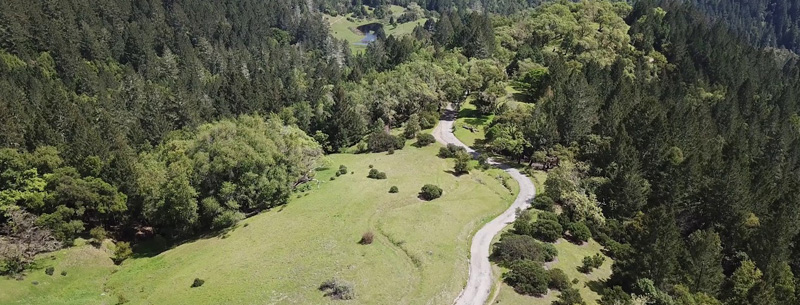
Armstrong Redwoods State Reserve
This beautiful, 5,000-acre reserve is open year-round. Creeks meander through the woods; some are flanked by picnic tables, making for a thoroughly enjoyable lunch spot. Children can play in the shallow creek, while parents watch and relax at the adjacent tables. Beautiful is an understatement for this serene spot, with its 1,000-year-old towering redwood trees. The trees keep the woods pleasantly cool in the summer, while they offer some protection from the rain during winter months.
- Location: 17000 Armstrong Woods Road, Guerneville, CA 95446
- Hours: Open daily at 8:00 am; closes one hour past sunset
- Phone: 707-865-2391
- Price: $1 per car; no charge for walkers or bicyclists
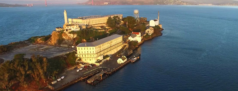
Alcatraz Island
This famous Alcatraz Island is best known for its history as a federal prison from 1934 to 1963. After landing at the dock and visiting the information center for an audio-visual introduction to the facility, the walk up the steep hill to tour the main prison buildings is not for the weak of heart. After the climb, enjoy a tape-recorded tour of the infamous penitentiary and be sure to wear a sweater and comfortable shoes.
- Location: Just a short ferry ride from Fisherman’s Wharf. Ferries leave from Pier 33
- Hours: Visit www.alcatrazcruises.com for hours
- Phone: 415-981-7625. Reservations suggested
- Price: Call for Fees
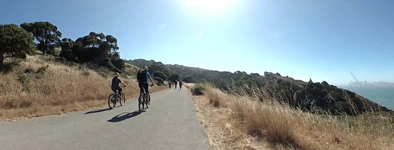
Angel Island
Angel Island is the largest island in the Bay. The island has miles of hiking trails and bike paths, winding past historic military structures and great vista points. Narrated tram tours circle the island. Campsites are available.
- Location: Take a ferry from Pier 41 to Angel Island
- Hours: Please call for hours
- Phone: 415-435-1915 Campsite info
- Price: Call for Fees
Barbary Coast Trail
The Barbary Coast Trail connects twenty of San Francisco’s most important historic sites. It is primarily a self-guided trail. Printed trail guides are available at numerous locations in San Francisco. Walkers follow a series of bronze medallions embedded in the sidewalk along Gold Rush-era streets and Chinatown alleys.
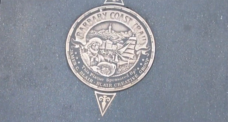
Along the way, discover decades of earthshaking history, vibrant neighborhoods, and scenic views, follow the 180 medallions in the sidewalks of San Francisco to see almost all of the 39 historic sites across 4.3 miles with a trip back on the historic cable car. Private tours are available by appointment. For information visit our website at www.barbarycoasttrail.org.
- Location: Beginning at the Old Mint, 5th & Mission
- Hours: Please call for hours
- Phone: 415-454-2355
- Price: Call for Fees
Bay Trail
The Bay Trail is a planned recreational corridor that, when complete, will encircle San Francisco and connect the shoreline of all nine Bay Area counties with a continuous 500-mile network of bicycling and hiking trails, linking 47 cities, and crossing the major toll bridges in the region. To date, approximately 290 miles of the Bay Trail has been completed.
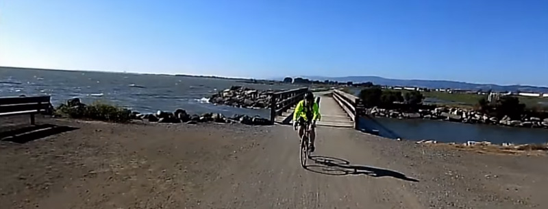
The Bay Trail provides easily accessible recreational opportunities for outdoor enthusiasts, including hikers, joggers, bicyclists, and skaters. Depending on the location of its segments, the Bay Trail consists of paved multi-use paths, dirt trails, bike lanes, sidewalks or city streets signed as bike routes. The Bay Trail also connects to trails that lead inland, and with the Ridge Trail, another regional trail network (which travels inland, mostly along the ridges of the hills). For more information, go to the Bay Trail website where you can download maps.
- Location: Nine Bay Area counties. See map for details
- Hours: Check website for hours
- Phone: baytrail.abag.ca.gov
- Price: Free except for bridge tolls
Crystal Spring Trail
This mid-peninsula trail is a network of links between may open spaces and parks. This long trail runs from Skyline Boulevard at Huddart Park up to the intersection of Skyline and Canada Road. Withing Huddart Park the trail winds up slopes to Skyline Boulevard. Richards Road trail in Huddart Park leads from this trail to the south entrance of the Phleger Estate. At the intersection of Canada and Edgewood, a trail leads east into Edgewood Park. West of the trail, just north of Edgewood, you’ll find the Filoli estate.
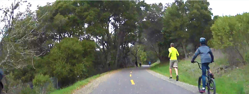
Common entree points to this long trail are at Skyline Boulevard, between Huddart Park and Purisima Creek Redwoods, at the corner of Raymundo Drive in Woodside; at the intersection of Edgewood Road and Canada Road; and near the intersection of Canada Road and Highway 92.
- Location: Skyline Boulevard at Huddart Park up to the intersection of Skyline and Canada Road
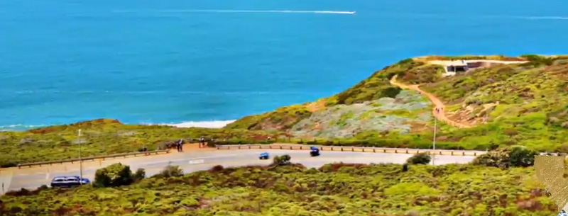
Coastal Trail
The entire northwest corner of San Francisco is part of the Golden Gate National Recreation Area (GGNRA). Take a hike along its scenic trail along the headlands for over 10 miles. Start at Point Lobos, at the end of Point Lobos Avenue, near Sutro Baths at the Pacific Ocean, and hike the coastline all the way to the Golden Gate Bridge.
- Location: Golden Gate National Recreation Area (GGNRA)
Embarcadero Waterfront
Stroll along the city’s waterfront along the Embarcadero from the foot of Market Street, past the historic Ferry Building on to great views of Treasure Island and the sailboats and freighters sailing beneath the Oakland Bay Bridge. Continue on the PIER 39 for great views of the Bay, Alcatraz and Angel Island, plus ferry cruises, attractions, shopping, dining and to see the colony of sea lions playing on the west end of the pier.
- Location: from the foot of Market Street to PIER 39
- Hours: 24 hours
Great Highway
Walk along Great Highway at the Pacific Ocean from the San Francisco Zoo at Sloat Boulevard to the Cliff House with restaurant, antique camera obscura, and Musee Mechanique featuring a collection of old coin-operated games and devices.
- Location: San Francisco Pacific Coastline
- Hours: 24 hours
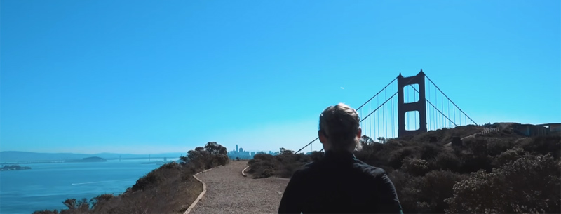
Golden Gate Promenade
A 4-mile trail from Aquatic Park in Fisherman’s Wharf through beautiful Marina Green and Crissy Field to Fort Point, a historic fortification built in 1861 set at the south end of the Golden Gate Bridge. Stop here for a ranger-led tour, or continue on with a walk across the Bridge for breathtaking views (but be sure to take a jacket as this walk is usually a windy one).
- Location: A 4-mile trail from Aquatic Park in Fisherman’s Wharf to Fort Point
- Hours: 24 hours
Golden Gate Park
Golden Gate Park offers miles of pleasant hiking or strolling paths near lakes, waterfalls, bridges, lawns, gardens, museums, public art, trails, and cultural attractions. Encompassing 1,017 acres, the Park, three miles long and a half-mile wide, is located on the city’s central west side and sits between the Richmond and Sunset Districts. The park’s tree-lined walkways are filled with hikers, joggers, cyclists, strollers, and skaters. Park information and maps are available at www.parks.sfgov.org. Click Golden Gate Park under Features for information and a map.
- Call for Fees, museums extra
Spring Lake & Howarth Park
Spring Lake and Howarth Park are two multifaceted recreation areas joined by a paved walkway and dirt trails. Spring Lake is a magnet for exercisers, who walk, stroll, bike, or run along the two-and-a-third-mile path that encircles the lake. Summertime opens up the swimming lagoon and beach area. Boating (not powerboats) and fishing are permitted year-round.
Campgrounds are open in the summer and on weekends and holidays. A concession rents canoes and paddleboats in the summer months. Picnic tables interspersed among groves of trees invite individuals and groups to enjoy the peaceful park areas in good weather, which is most of the time.
Howarth Park has wonderful attractions for children. K-Land offers pony rides, a petting zoo, a merry-go-round, and a train that circles the parking area. Western Town and the playground can keep kids happy for hours while their parents enjoy sitting under the trees or lounging on the lawn areas. Picnicking and barbecuing are made easy with ample facilities. During the summer there is a concession offering cold drinks, snacks, and a small fast-food menu. The adjacent Lake Ralphine offers the rental of non-motorized boats and lots of hungry ducks to feed.
- Location: 630 Summerfield Road, Santa Rosa 95403
- Hours: Daily 6:00am – 9:00pm
- Phone: 707-543-3282
- Price: Call for Fees, museums extra
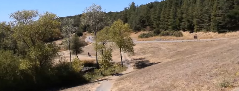
Sunol Regional Wilderness
Bedrock mortars used by Native Americans for pounding acorns that were found in the area are reminders of Sunol`s first inhabitants. For the past century, however, the land known today as Sunol Regional Wilderness was used almost exclusively as ranch land. Under the East Bay Regional Park District`s multi-use land management policy, cattle continue to graze in the 6,858-acre wilderness.
Naturalist-led activities include walks, hikes, camping, backpack and horseback programs, and various other adventures. Visit the Old Green Barn Visitor Center for information about these programs and the self-guiding Indian Joe Nature Trail.
- Location: P.O. Box 461, Sunol, CA 94586
- Hours: 7 a.m. to dusk all year, unless otherwise posted or permitted
- Phone: 925-862-2244
- Price: $3 seasonal, weekends and holidays
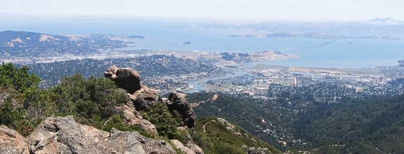
Mount Tamalpais
On the south slope of this mountain in Marin County is one of the West Coast’s most beautiful footpaths, left from the tracks of a train that scaled the mountain at the beginning of the century. The Old Railroad Grade starts in Mill Valley and leads to many miles of trails that cross the green slopes of Mount Tam.
- Location: The Old Railroad Grade starts in Mill Valley
- Hours: Please call for hours
Stanford Univesity
Another famous Bay Area University with a campus worth walking. Student-led one-hour campus walking tours start at the Information Center in front of Memorial Hall daily at 11am and 3:15pm. Check out the Visitor Information section of the Stanford web site at stanford.edu for ideas on some sights to see. The adjacent city of Palo Alto has a charming city center that is worth a visit.
- Phone: 650-723-2300
Tildon Park
Tildon Park in Berkeley is the crown jewel in the East Bay Regional Parks District. The East Bay Skyline National Recreational Trail follows scenic Nimitz Way, popular with hikers and bicyclists, and other trails on its 31-mile route.
Tildon Park also includes a Botanical Garden, Lake Anza with sandy beaches and year-round fishing, Little Train scenic steam train rides, an 18-hole golf course, carousel, pony rides, and a Nature Learning Center. For public transportation, take BART to the Berkeley station, then AC Transit #67. 818-1717 for transit information. For other East Bay parks and trails, go to www.ebparks.org.
- Location: The park is located in the Berkeley hills just north of Highway 24. Entree points on Grizzly Peak Boulevard and Canyon Road
UC Berkeley
Pick up a self-guided walking tour packet at the UC Berkeley Visitor Information Center, 2200 University Avenue @ Oxford Street, University Hall, Room 101 (open Monday through Friday) and set off for a walk around the world-renowned campus with such sights as Campanile Tower, Sproul Plaza, Hearst Mining Building and Sather Gate. Adjacent Telegraph Avenue in Berkeley is worth a stroll for shopping and grabbing a bite.
Location: UC Berkeley Visitor Information Center, 2200 University Avenue @ Oxford Street
- Hours: Free 1 1/2 hours tours are offered Mon-Friday at 10 am, beginning at the Visitor Center; and Saturday at 10 am and Sunday at 1 pm leaving from in front of the Campanile in the center of the campus.
- Phone: 510-642-5215