Until a friend of mine invited me to tag along on a hiking trip in northern Arizona and southern Utah, I’d never heard of The Wave. But I realized when we arrived that I’d definitely seen photos of this amazing formation, now an internationally known and very popular site. This is why daily visitation has been limited by the Bureau of Land Management, to prevent excessive damage, crowding, and overuse of the area.
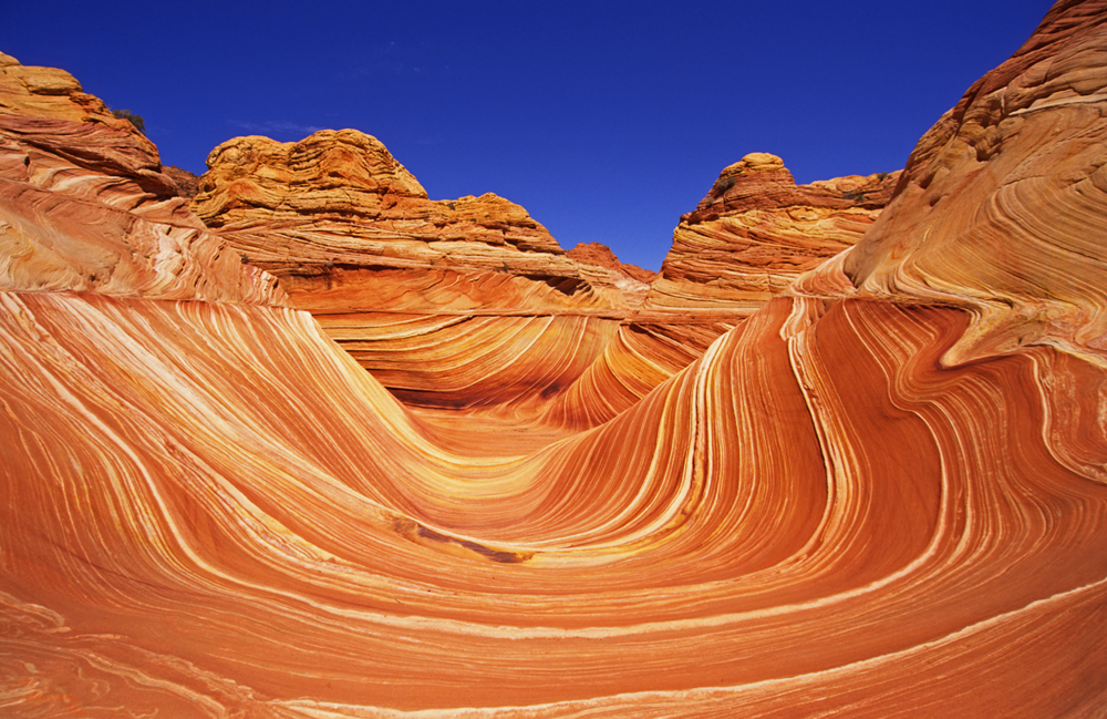
If you are willing to take your chances with the permit process, which I’ll describe below, and are able to hike six, mostly easy to moderately difficult miles in desert terrain, I highly recommend a visit to The Wave. Here, I’ll show you photos from my hike, describe the route, the terrain, and a little of the geological history of the area and tell you how to get there once you’ve obtained your permit.
You’ll begin your hike to The Wave by walking up a wash. This wash would eventually lead you into Buckskin Gulch, the world’s longest slot canyon, but you’ll turn off to the right–south/southeast–well before then.
The Trail Towards The Wave Departs From The Wash
But you’re not on a trail for long.
After following the wash for less than a mile, you’ll see a signpost on your right: “Coyote Buttes.” All hikers need a permit to enter this area, whether or not they’re headed for The Wave. And The Wave requires a specific permit, which should be displayed on the backpack of one person in each party.
When you first turn off from the wash, you’ll climb a short but steep, sandy hill, which will get your heart rate going. This and the final climb up a sand dune just before The Wave are the most difficult parts of the hike.
Due to a number of people getting lost in the area, the Bureau of Land Management has amended the material they give out to permit-holders to include GPS coordinates of various points along the route and a photographic map of features to keep an eye out for. If you pay attention to the directions and the terrain, you should have no problem finding The Wave; although, we did still run into people out there who seemed confused.
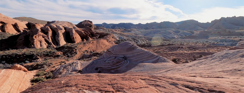
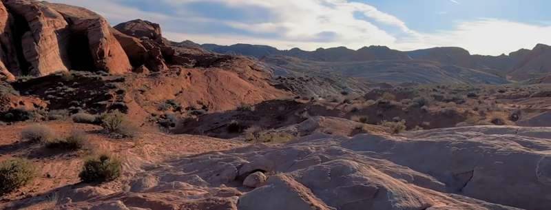
A View Of The Landscape En Route To The Wave
This stark, other-worldly, and amazingly beautiful land also gets extremely hot in the summer. So, if you’re hiking in June, July or August, be sure to start early, carry plenty of water (at least a gallon, I’d say), and wear a wide-brimmed hat.
The Route To The Wave: Sand And Slickrock
With some small, scattered cairns along the way
After a short stretch on a sandy trail, you’ll come to a large area of slick rock, which, when dry, offers very good footing. Here, you’ll no longer be guided by trail but rather by terrain features and, here and there, small cairns. I found these cairns easy to miss and sometimes a bit confusing, but you’ll probably spot most of them if you keep a careful eye out. They really aren’t necessary, though, to find your way.
Head For The Twin Buttes
The BLM instructions will point you to the right of two large … well, I call them rock lumps, but they’re officially called the “Twin Buttes.” They should be pretty easy to identify from the photos on your handout. Still, even if you stray in this area, another major feature in the distance will draw you into the right spot.
Navigating To The Wave Shouldn’t Be Difficult
,..if you follow directions and pay attention to the map and terrain
Here, my friend Sueanne walks to the right of the Twin Buttes. The buttes can be passed on the left, but it’s easier to walk up the slickrock bowl and go around to the right. Half a mile past the Twin Buttes, you’ll come to a wash. If you look across the wash, you’ll see the multicolored domes on the opposite side. These and the sandstone formations to the right are where The Wave is located.
Video: Hiking To The World-Famous Wave
Some hikers (who I don’t know) made this nice video of hiking to The Wave and some of what you’ll see when you get there.
The Wave Permit Process
It’s not the fun part of The Wave experience, but it is required.
My friend and I got lucky. Ours was the third application drawn that morning, as more than 50 people waited at the White House Ranger Station to find out if they’d get a permit for The Wave for the following day. There were spots remaining for only two more people, and the remaining parties were of three and four people.
Only 20 people are allowed into The Wave each day, with a maximum group size of six. Ten spots are reserved for the in-person permit lottery at the Ranger Station, beginning at 9 am each morning, and ten other slots are doled out by the online lottery system. You’d need to arrive at the Ranger Station early to fill out the application and be entered into the drawing.
For the online lottery, you have to pay a $5 nonrefundable application fee, and you can choose up to three dates per application. If you win a permit, you will be given just one of the three days. With the in-person lottery, you pay only if you receive a permit. The permits are $7 per person.
Online permits may be obtained up to four months in advance. At noon Mountain Standard Time you would need to be on the computer making application and calling the Ranger Station at the same time at (435) 688-3230 to double your chances.
Off-season (mid-November to mid-March) the lottery runs only 5-days-a-week from. The Paria Information Station issues permit for Saturday, Sunday, and Monday on the previous Friday.
Visit the BLM website for more information on how to obtain a permit for The Wave. Or skip right to the permit application process.
Be aware that the area is patrolled by rangers, and fines will be issued to those without permits. A copy of the permit will also need to be displayed on the dashboard of your vehicle.
Directions To The Wave Trailhead
on House Rock Valley Road
The Wave is located in the Coyote Buttes area south of US Highway 89 between Page, Arizona, and Kanab, Utah. The hike begins at the Wire Pass Trailhead on unpaved House Rock Valley Road in the Paria Canyon – Vermillion Cliffs Wilderness. The turnoff from US 89 onto House Rock Valley Road is not signed, but it’s located between mile markers 25 and 26 about 40 miles east of Kanab or 34 miles west of Page. This turnoff is 4 miles west of the Paria Ranger Station where you may have obtained your permit. When House Rock Valley Road is wet, it can become impassable. During dry conditions, however, a two-wheel-drive vehicle is sufficient, though high clearance would be preferable.
About 4.2 miles south of US 89 on House Rock Valley Road, you pass the Buckskin Trailhead on your left. Then, 3.7 miles further is the Wire Pass Trailhead with a large parking area and restrooms. The parking area in on the left (heading southbound), but the actual trailhead is on the left.
The trailhead is located in Utah, while The Wave itself is actually in Arizona.
Trailhead coordinates: 37 degrees 1.19’N / 112 degrees 1.48’W
Zoom out (using the minus button) to see where House Rock Valley Road is located.